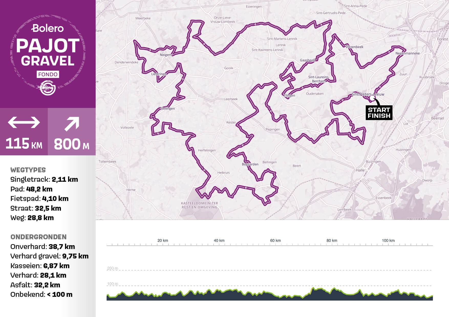
Course
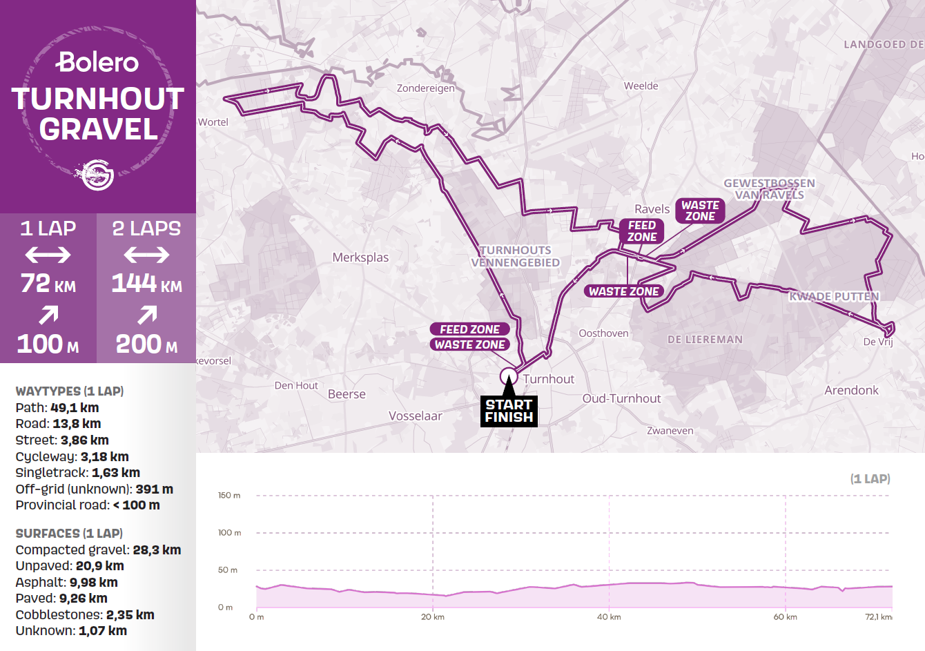
View the Turnhout Gravel course map here.
- 72 km = 1 lap (100 meters of elevation gain): official qualification distance for men 60+ and women 50+.
- • 144 km = 2 laps (200 meters of elevation gain): official qualification distance for elite men/women, men 19-59 years, and women 19-49 years.
Feed zones
There are 2 feed zones on the course at the following locations:
- Feed zone 1: Plamaten 2, 2300 Turnhout
- Feed zone 2: Grote Baan 199F, 2380 Ravels (under the bridge)
Attention: No filled cups will be provided at the aid stations. You can refill your water bottle using a water tap.
In addition to the feed zones, team staff and helpers may also supply their riders on all paved roads. It is not allowed to provide supplies to riders on unpaved roads! This may lead to a possible disqualification.
Spectator zones
Do you want to come and cheer on the riders? The following locations along the course are easily accessible and ideal for supporting them.
- Spectator zone 1: Berkelaar 3, 2330 Merksplas
- Spectator zone 2: De Brulen 20, 2370 Arendonk
Waste Management
The Turnhout Gravel course passes through highly sensitive natural areas. Please respect the environment and dispose of waste only in the designated waste zones. Riders who discard waste outside of the waste zones will be disqualified. The waste zones are marked with signs and located at the following kilometer points: 1 km, 41 km, 66 km, 75 km, 115 km, and 140 km.
GPX (official race course)
Download the official race course of Turnhout Gravel below.
View or download the routes via Komoot.
Download the GPX file of your route here.
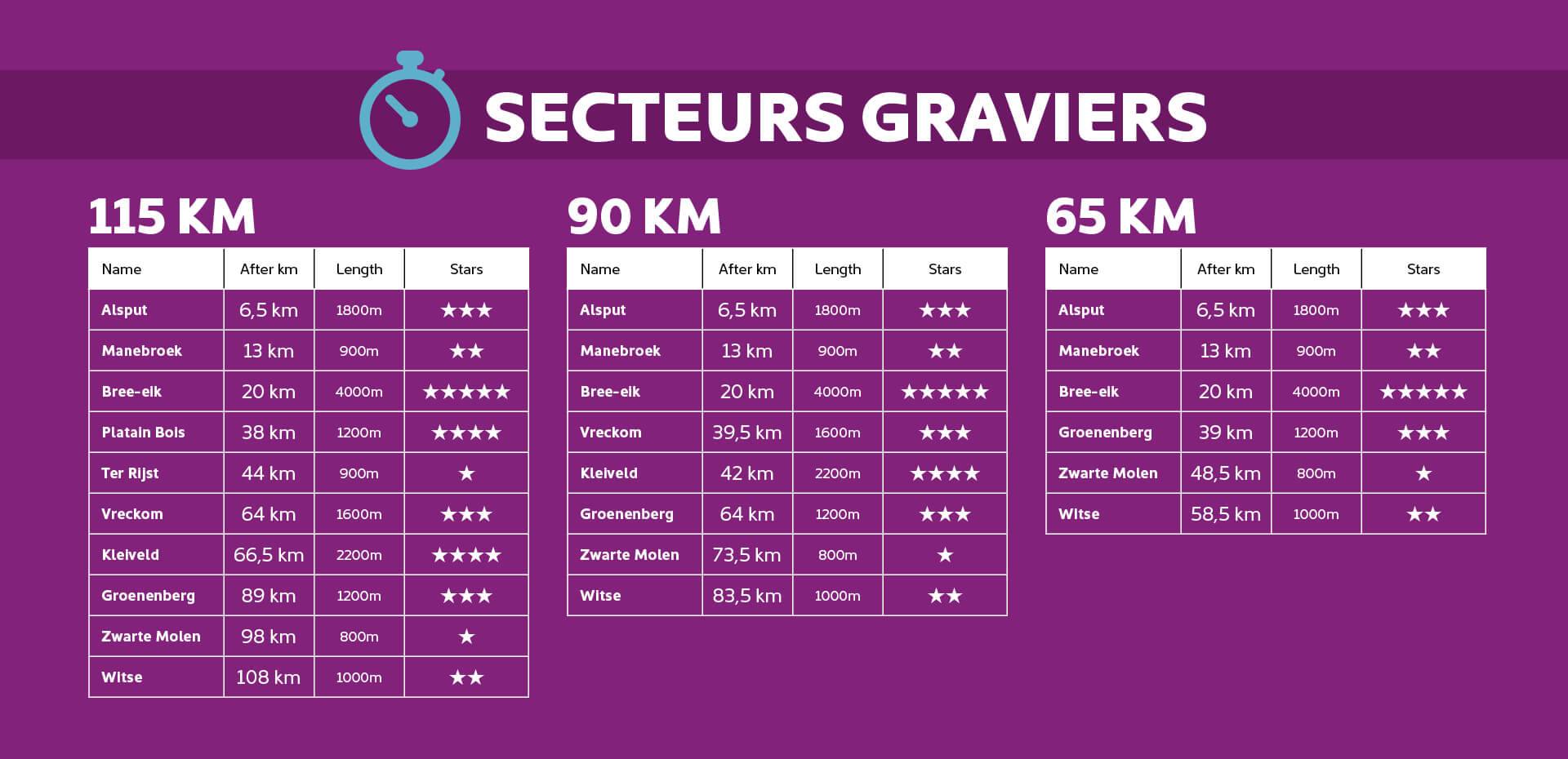
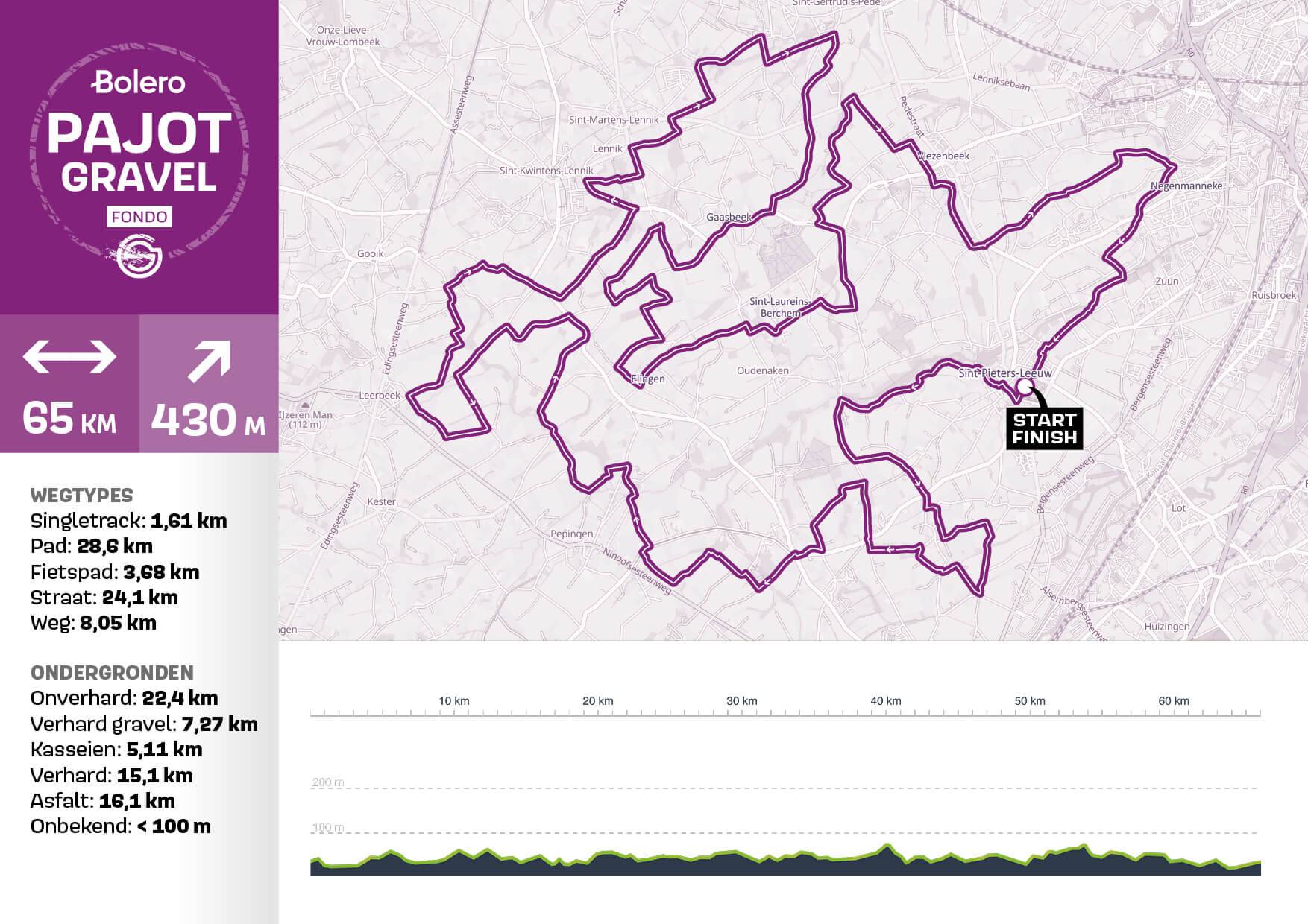
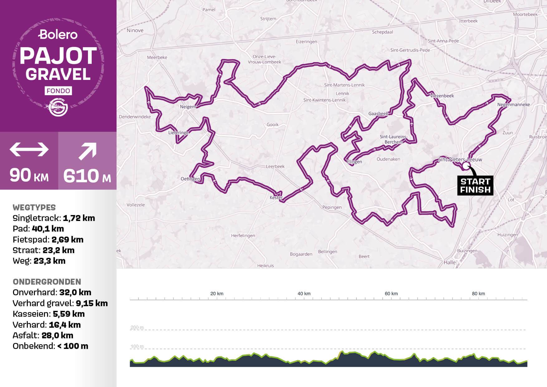
You have the choice of 3 distances*:
- 65 km (± 430 meters of elevation gain)
- 90 km (± 590 meters of elevation gain)
- 115 km (± 790 meters of elevation gain)